
Real-time elevation mapping across 12 days
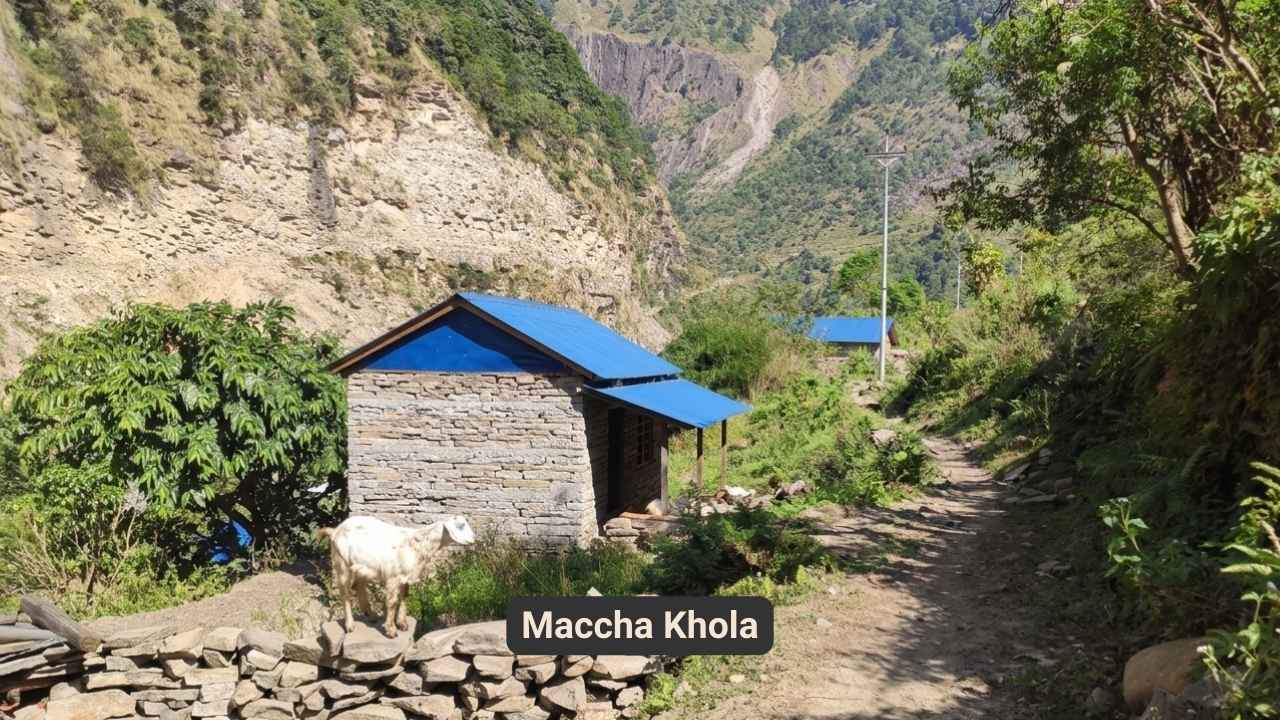
The journey begins with an early departure from Kathmandu, heading west along the Prithvi Highway before branching into the hills toward Dhading Besi. The road winds through terraced fields, small villages, and alongside the Trishuli River, offering glimpses of rural life. After a few hours, the route turns off-road toward Arughat and Soti Khola, where the terrain becomes rougher and the scenery more dramatic. The Budhi Gandaki River appears, carving through steep gorges. The drive is long, about nine hours but the changing landscapes make the time pass quickly. By late afternoon, Machha Khola is reached, a small riverside village where trekkers settle into a simple tea house for the night.
The trail follows the Budhi Gandaki River upstream, crossing suspension bridges and passing through small settlements like Khorlabesi and Tatopani, where natural hot springs offer a brief respite. The path climbs and descends through forests and rocky sections, with occasional views of waterfalls and terraced hillsides. After crossing the river again at Doban, the route ascends toward Jagat, a stone-paved village that marks the entry point to the Manaslu Conservation Area. The day's trek takes about six to seven hours, ending in Jagat, where a permit check is required before continuing. The village offers a glimpse into traditional Gurung culture, with prayer flags fluttering in the breeze.
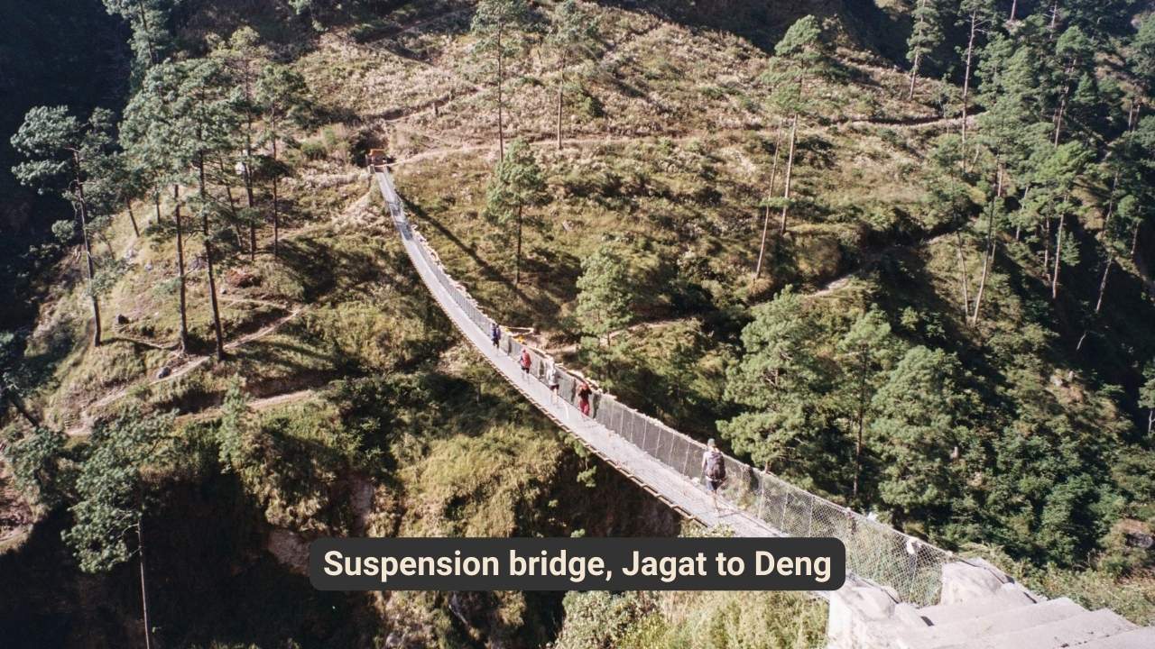
The trail climbs steadily from Jagat, passing through Salleri and Sirdibas, where the first signs of Tibetan Buddhist influence appear in the form of prayer wheels and mani walls. The route crosses the Budhi Gandaki River twice via suspension bridges, offering views of the steep-sided valley. After a steep climb to Philim, a large Gurung village, the path descends to the river again before ascending through bamboo forests to Deng. The day's trek is long, covering about 18 kilometers in six to seven hours. Deng is a small, quiet village nestled in the valley, offering a peaceful place to rest before the next day's climb.
The trail ascends gradually from Deng, passing through pine and rhododendron forests. The route crosses the Budhi Gandaki River multiple times, with views of the steep valley walls. Villages like Rana and Bihi Phedi offer glimpses of local life, with terraced fields and traditional stone houses. The path climbs steadily to Ghap, where mani walls and prayer flags mark the increasing Tibetan influence. The day's trek is about 19 kilometers, taking six to seven hours. Namrung, the day's destination, is a larger village with stunning views of the surrounding peaks. The air grows cooler as the altitude increases, and the landscape becomes more rugged.
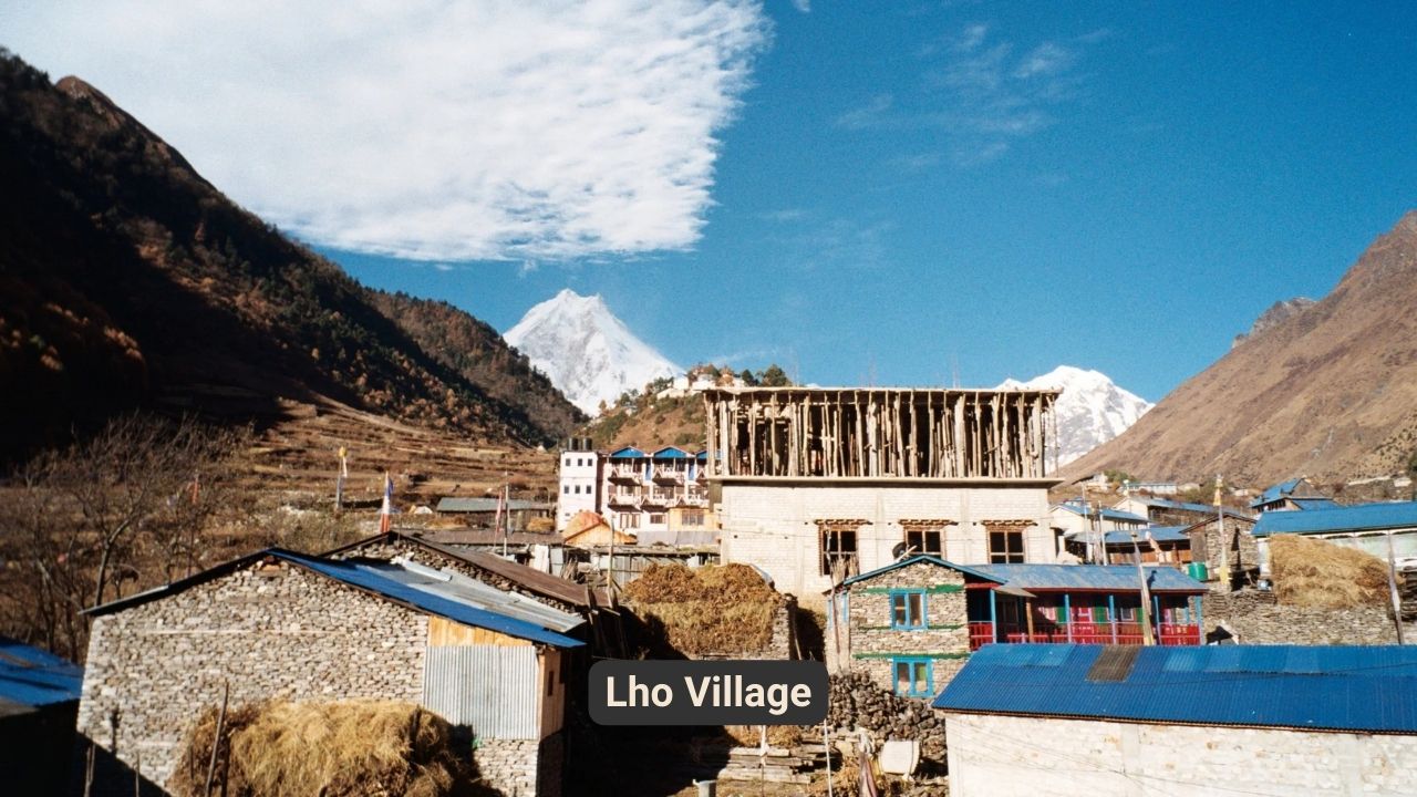
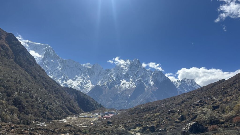
The trail climbs steadily from Namrung, passing through Lihi and Sho before reaching Lho. The route offers increasingly dramatic views of the surrounding peaks, including Saula Himal and Pangkar Himal. The path winds through forests and open hillsides, with occasional glimpses of yaks grazing in the meadows. Lho is a larger village with a prominent monastery, Ribung Gompa, which offers panoramic views of the Manaslu range. The day's trek is shorter, about nine kilometers, taking four to five hours. The cooler air and higher altitude make the climb more challenging, but the views are worth the effort.
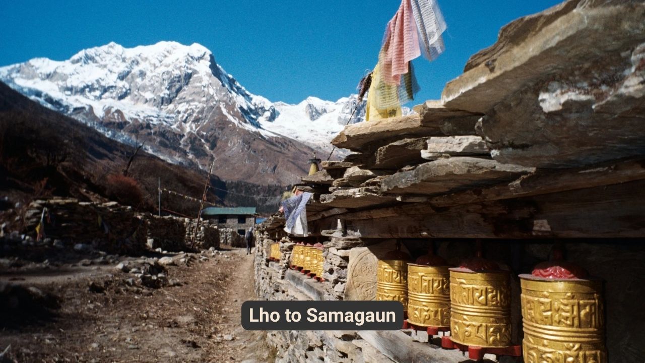
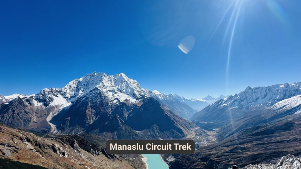
The trail climbs gradually from Lho, passing through forests and open meadows. The route offers stunning views of the Manaslu range, with the peak itself becoming more prominent as the trail ascends. The path passes through Shyala, a small village with panoramic mountain views, before descending into the Samagaon valley. The day's trek is about nine kilometers, taking four to five hours. Samagaon is a traditional Tibetan village, with stone houses and prayer flags fluttering in the wind. The village is situated at the base of Manaslu, offering a close-up view of the peak and a chance to experience local culture.
The day is spent acclimatizing to the altitude, with optional hikes to nearby attractions. A popular option is a hike to Pungyen Gompa, a monastery with stunning views of Manaslu. Another option is a visit to Birendra Lake, a glacial lake surrounded by rugged peaks. The day is also an opportunity to explore Samagaon village, with its traditional stone houses and prayer flags. The air is thinner at this altitude, making even short walks more challenging. The day is a chance to rest and prepare for the higher altitudes ahead.
The trail climbs gradually from Samagaon, passing through alpine meadows and yak pastures. The route offers views of the Manaslu glacier and surrounding peaks. The path crosses the Budhi Gandaki River, following its left bank to Samdo, a small village near the Tibetan border. The day's trek is about eight kilometers, taking three to four hours. Samdo is a Tibetan refugee village, with traditional stone houses and a unique cultural atmosphere. The village is situated in a remote, high-altitude location, offering a chance to experience life in a harsh but beautiful environment.
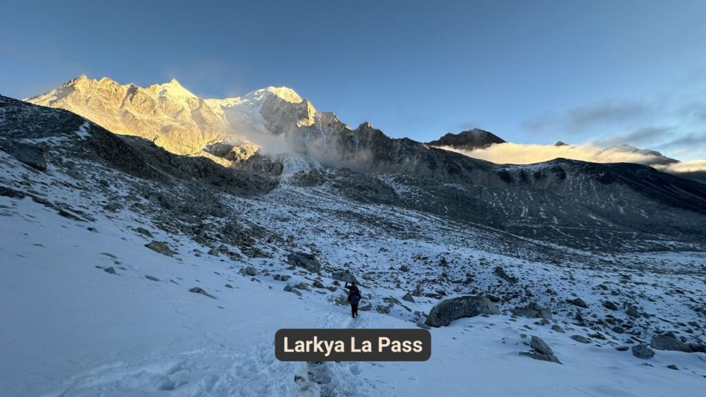
The trail climbs gradually from Samdo, passing through barren, rocky terrain. The route offers views of the Larkya Glacier and surrounding peaks. The path crosses two streams before reaching Dharamsala, also known as Larkya Phedi, a basic lodge at the base of the Larkya La Pass. The day's trek is about seven kilometers, taking three to four hours. Dharamsala is a simple, remote lodge, offering basic accommodation and a chance to rest before the next day's challenging pass crossing. The air is thin and cold, making the climb more difficult, but the stunning views make it worthwhile.
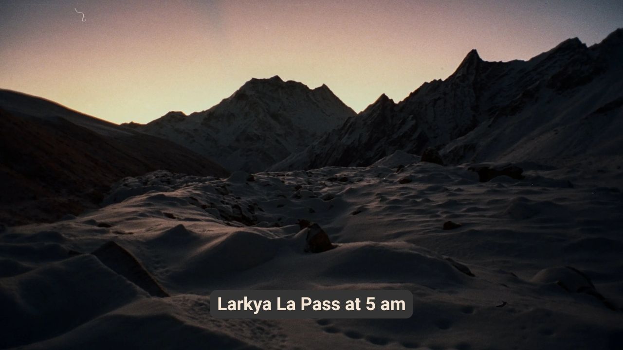
The day begins early, with a steep climb to the Larkya La Pass, the highest point of the trek at 5,160 meters. The route offers stunning views of the surrounding peaks, including Himlung, Cheo, Kang Guru, and Annapurna II. The descent from the pass is long and steep, leading to Bimthang, a beautiful valley surrounded by snow-capped peaks. The day's trek is about 18 kilometers, taking eight to ten hours. Bimthang is a peaceful village, offering a chance to rest and reflect on the challenging pass crossing. The air is thinner at this altitude, making the descent more difficult, but the stunning views make it worthwhile.
The trail descends gradually from Bimthang, passing through rhododendron and pine forests. The route follows the Dudh Khola and Marsyangdi River, offering views of the surrounding peaks. The path passes through villages like Gho, Tilije, and Thonje, offering glimpses of local life. The day's trek is long, about 25 kilometers, taking seven to eight hours. Dharapani is a larger village, marking the end of the Manaslu Circuit and the beginning of the Annapurna Circuit. The village offers a chance to celebrate the completion of the trek and reflect on the journey.
The journey back to Kathmandu begins with a jeep ride from Dharapani to Besisahar, followed by a bus ride to Kathmandu via the Prithvi Highway. The route follows the Marsyangdi and Trishuli rivers, offering views of the surrounding hills and valleys. The drive is long, about eight to nine hours, but offers a chance to reflect on the trek and the stunning landscapes encountered along the way. By late afternoon, Kathmandu is reached, marking the end of the Manaslu Circuit trek.
Compare verified local operators for your Manaslu Circuit Trek adventure.
All agencies are vetted for safety standards, licensing, and insurance compliance.
Find a lower price elsewhere and we'll match it plus give you a $50 credit.
Direct line to our trekking experts for any questions during your journey.
 Ace the Himalaya
$
1,800
Ace the Himalaya
$
1,800
Interested in this package? Get a personalised quote.